Lot Status
Get a real time glimpse of the status of your projects with geospatial data laid on top of 2d and 3d maps. Built-in tools into the map allow you to see lot and sales history directly in the mapping applications via connections to the lot management interfacing.
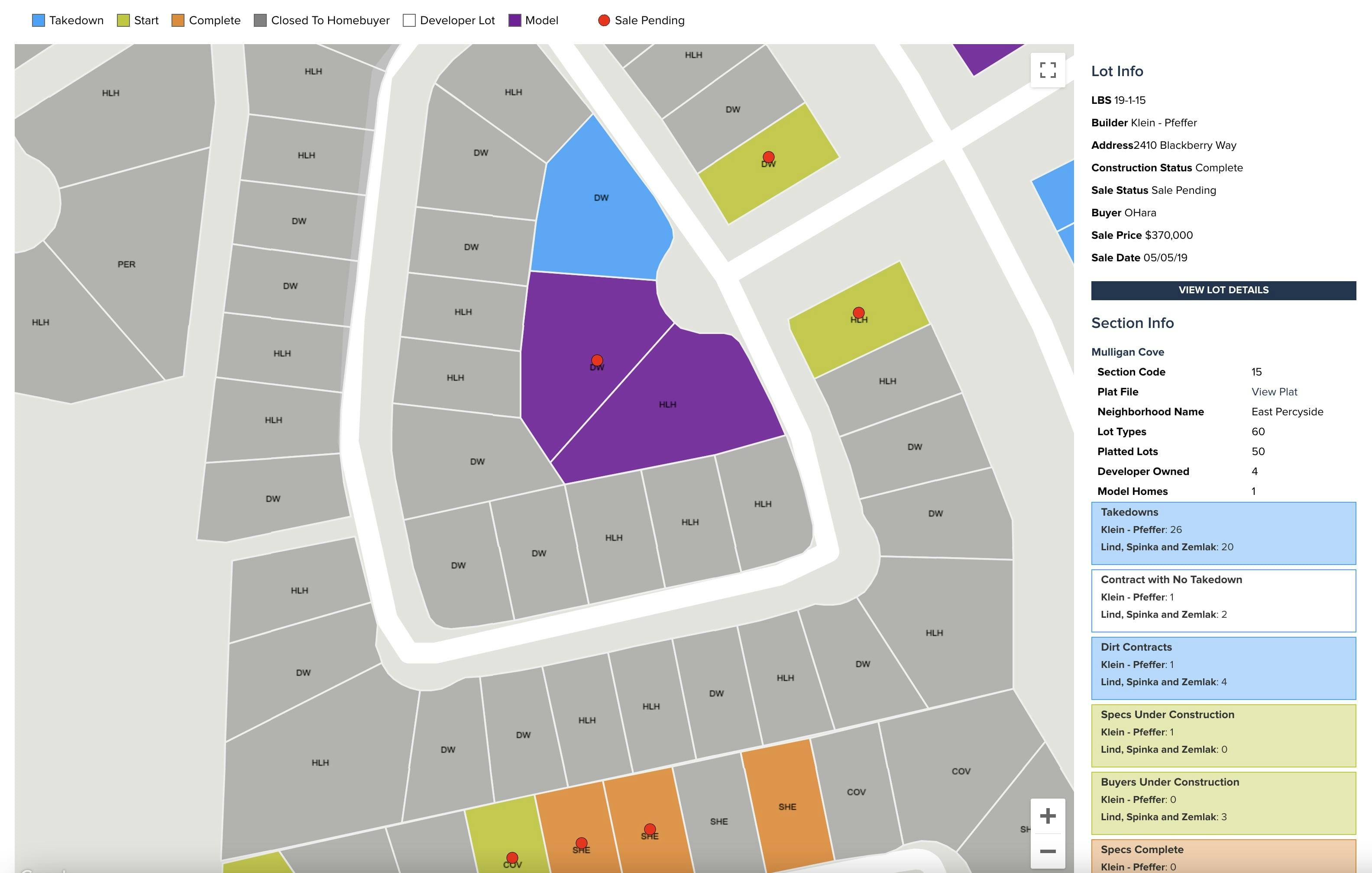
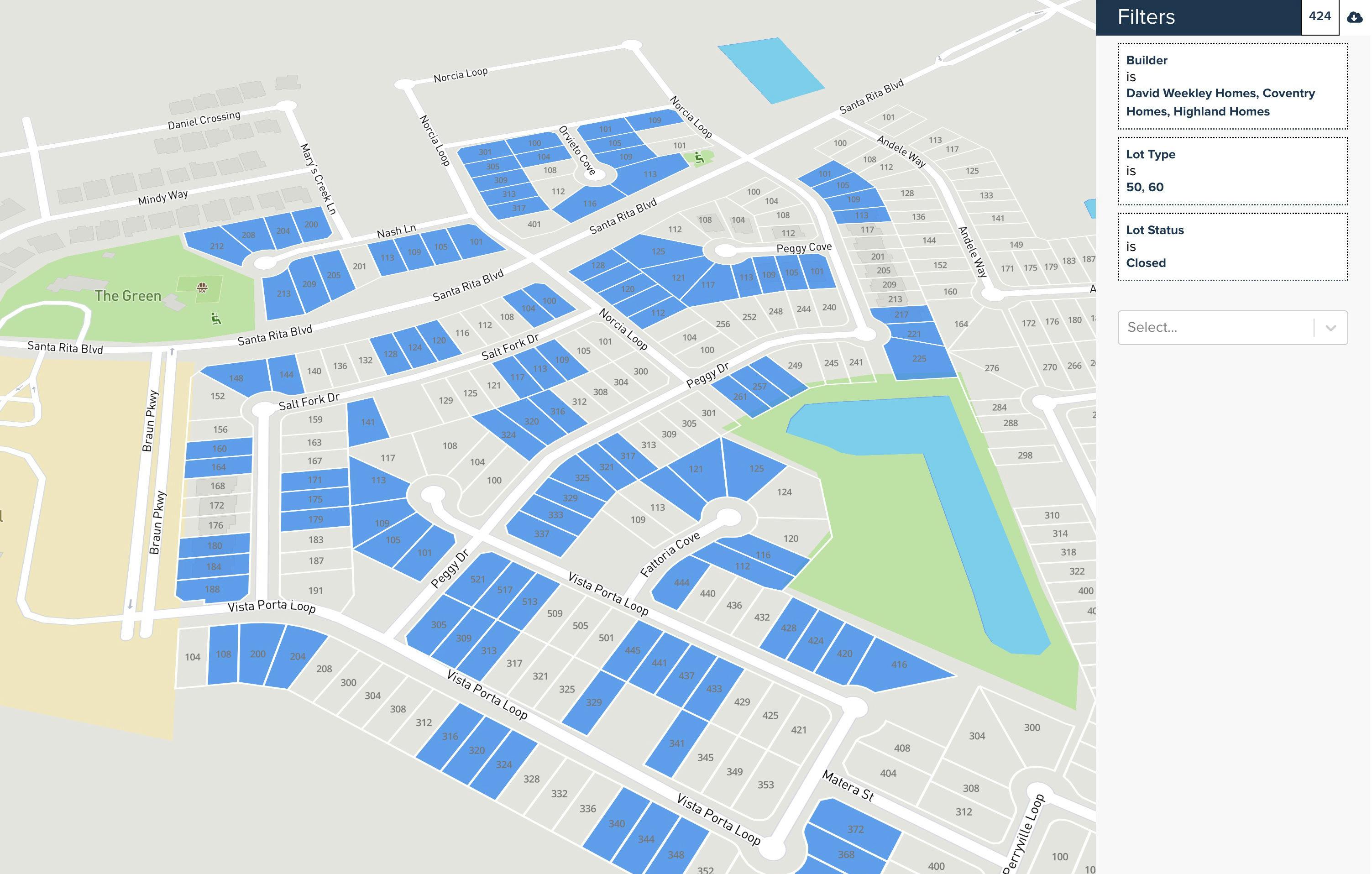
Lot Map
An advanced mapping application allows administrators to quickly filter and find lots that match specific criteria. Query on almost anything related to the lot record such as builder assignment, takedown/start/complete/sale/closing dates, lot premiums, acreage, frontal footage, lot types, and over 100 other possibilities. Once the lot set has been established an instantaneous Excel export becomes available.
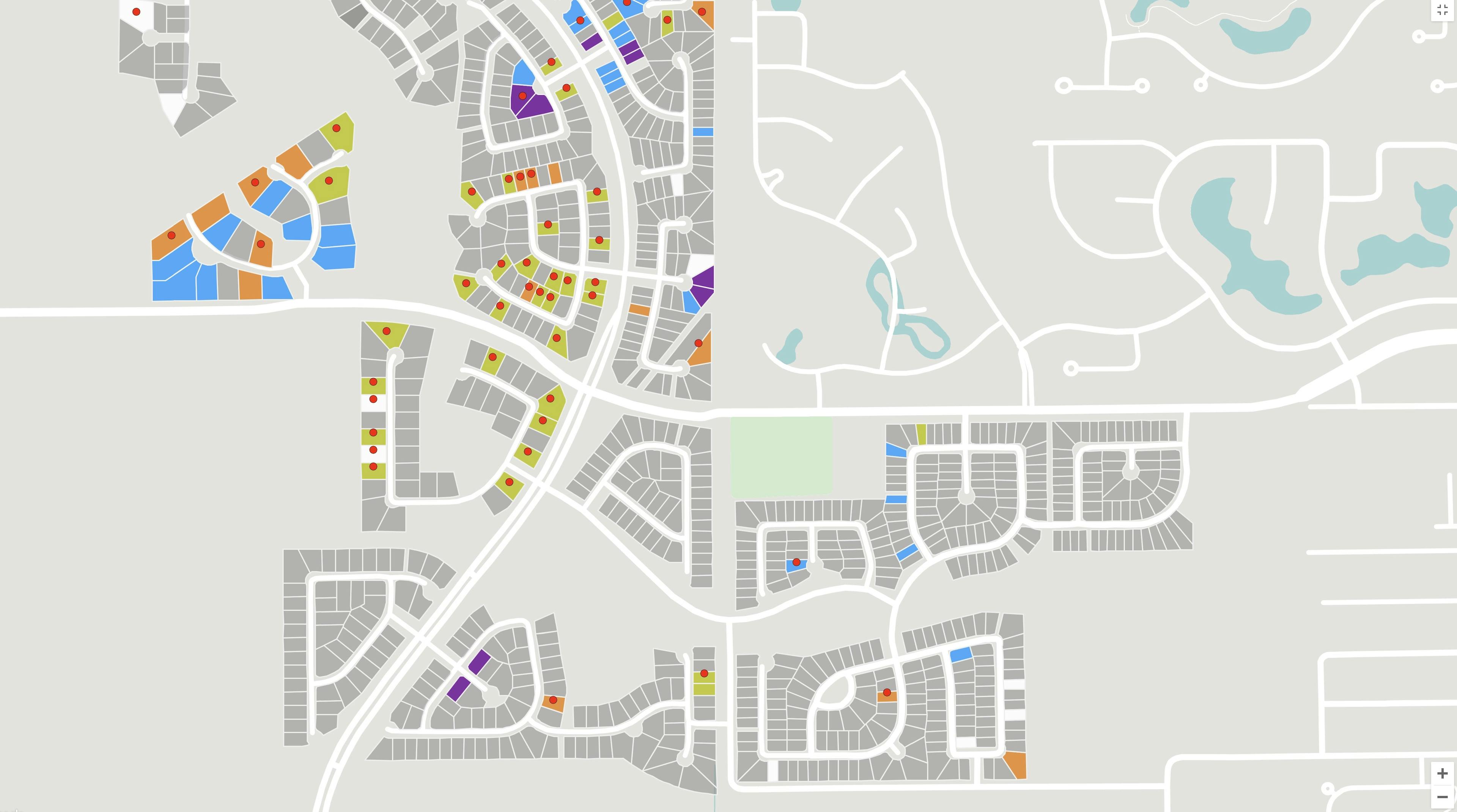
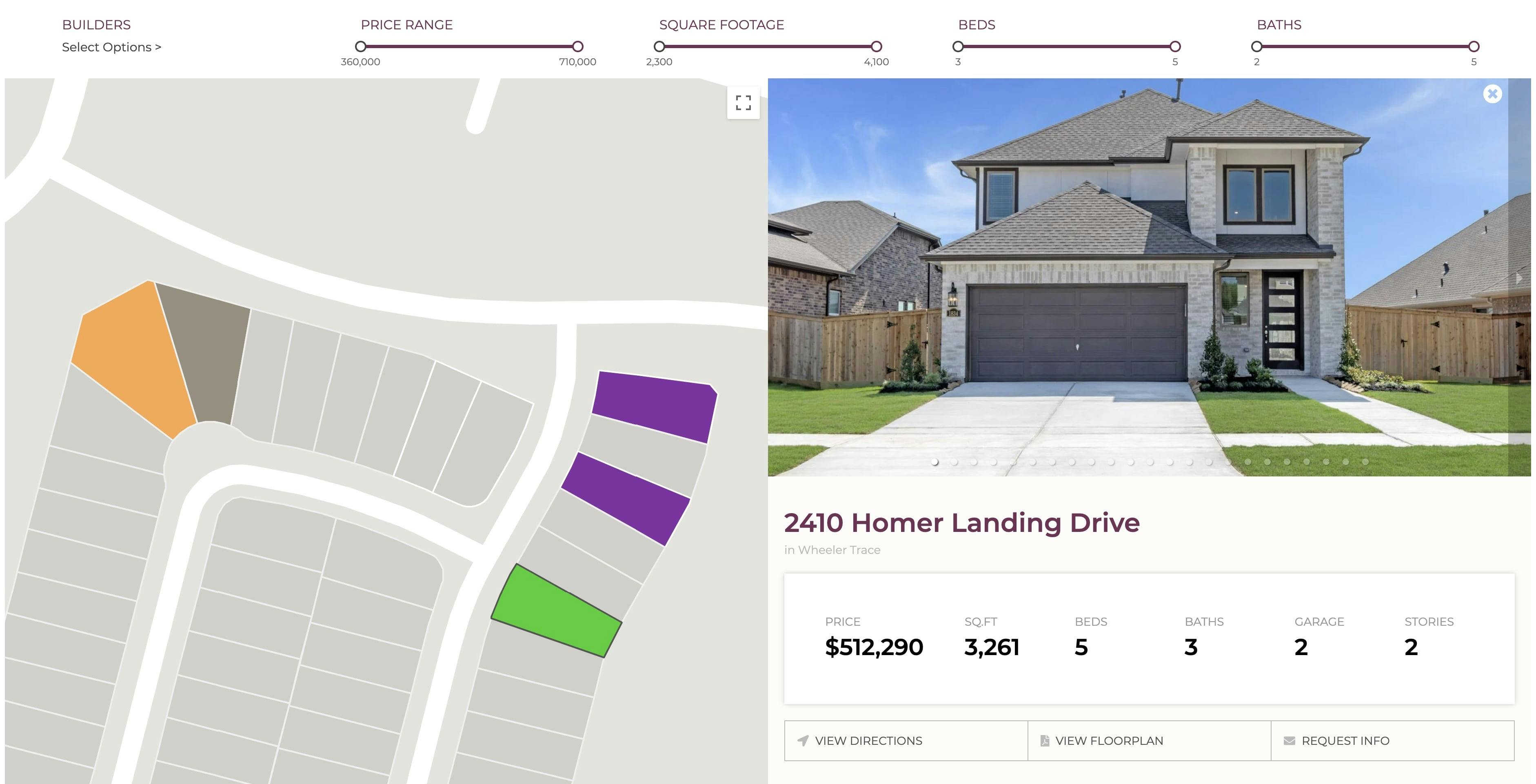
Public Mapping
Bring the power of Pipsy's mapping to your public facing websites by giving potential buyers an aerial view of your project to quickly find that perfect lot. Built in instant-refresh filters allow for quick and easy access to your inventory.
On-demand Satellite Construction Mapping
Automated and on-demand satellite construction mapping allows you to see the progress of your project from the sky. Lot overlays allow you to quickly spot missing starts and completions.

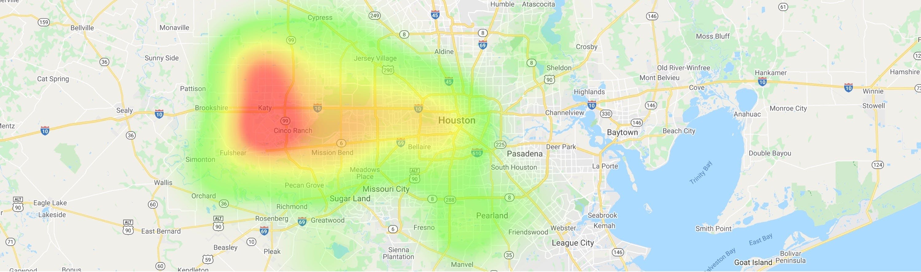
Sale and Closing Heat Maps
Determining where to send direct mail and where to place billboards just got a lot easier. Heatmaps show where both your sales and closings are coming from so you can spend your marketing dollars wiser.